As soon as we saw a glimmer of good weather, we knew we needed to take our kayaks out for a spin. We live in an area surrounded by snaking rivers (including the Snake River), which is why we lugged our kayaks all the way across the country. We've missed our kayaks. Last summer, they stayed in storage as we traversed the country. The summer before, we took them out a whopping one time. The summer before that, we were busy walking from Maine to Georgia. So it's been a long time coming.

The crucial question is, do we possess the skills to navigate these NE Oregon/Washington/Idaho rivers safely. I've had a few near-death experiences in the wilderness and one of them was a kayaking trip in 2005 where my skills were nowhere near a match to the river. Therefore, I cannot overstate my conservative approach when it comes to kayaking excursions. At the same time, I love being on the water in my kayak. If backpacking is my top love affair, kayaking is a close second. In any case, we did our research and picked what seemed like the safest 19-mile section of the Grande Ronde that crosses from Troy, Oregon and stops at Boggan's Oasis in Washington.

The Grande Ronde River runs 91 miles and is fed by snowmelt from Elkhorn Mountains. Part of it was designated by Congress as National Wild and Scenic River. In our research, we found that the river swells and dries up within days, but during this time of year, it regularly runs at 5,000 cubic feet per second, which is classified as "medium." This is a 3 to 5 mph pace. Though the experts say kayaks & canoes will do fine in these conditions (Class I-III in our estimates), we knew this would be at the top of our skill level.
Thus far, our paddling experiences have been 90% float and 10% work. Today, the numbers flipped. This could be best described by the fact it only took us under 4 hours (with breaks) to run 19 miles.
Luckily for us, there is a dirt road that rides along the 19 miles and we drove it several times beforehand to see what we were up against. We took notes about when to go to the left and when to go to the right. As we found out, the river looks very different when it is staring you in the face.
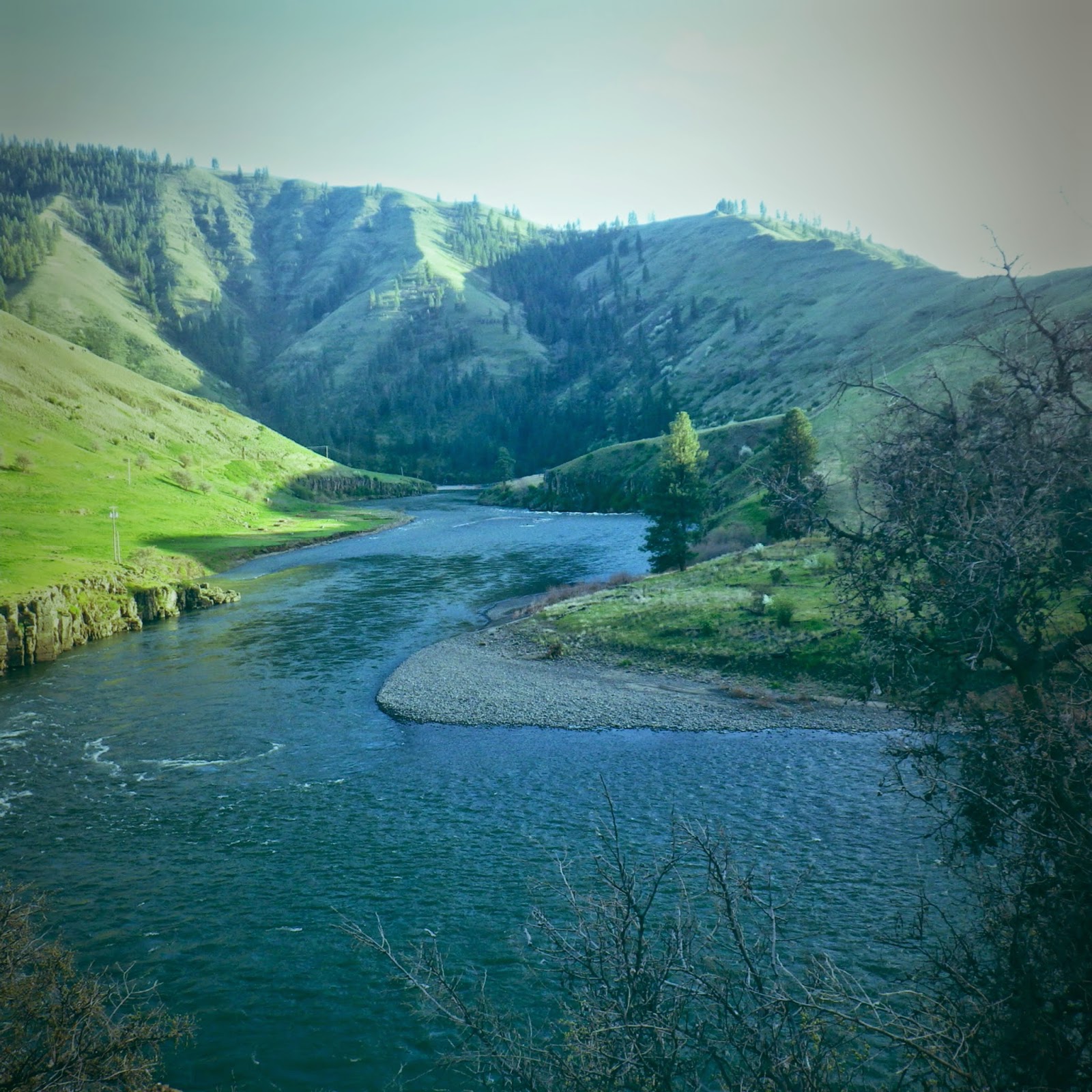
Looks so calm and inviting from the road
The rapids alone would provide a challenge, but they were combined with a number of blind, tight turns and frequent divides into channels. I wouldn't say we were out of our league, but I will say I am surprised we didn't capsize (which is good considering that the water was insanely frigid) and perish. This was not a case for "ladies first." J is more capable of reading rapids and deciding which line is safest, so I made him go ahead.
this is the only action shot I could muster
a GPS snapshot of the river
Even though I was wearing a skirt, which is meant to keep the water out, we had to do a lot of bilge pumping!
Once we maintained a normal heart rate (actually, that never happened), we enjoyed the surrounding beauty when the rapids weren't spilling over our boats. The rest of the world disappears amongst the mix of rugged canyon walls, shady ponderosa pines, dense conifer forests and (ripe) avocado green grassy slopes in the Grande Ronde valley. Only the power lines up above confirm that there is civilization nearby. And by civilization, I mean that cows outnumber people in population. The only sounds are the rumbles from the rapids and the birds chirping in every direction. We even spotted (quickly as we were racing by) a HUGE bald eagle!!
My apologies for the lack of pictures. Blame it on the fact that we were just trying to stay alive!
Hopefully there will be many more kayaking trips this summer. And hopefully we get better and better at this hobby.
Labels: Outdoor Recreation